What a Property Surveyor Does in Palm Beach County — Including the Survey Nobody Mentions
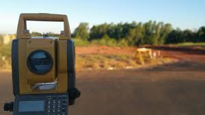
You have seen them: a tripod in the street, flags along a property line, someone in a high-visibility vest making notes. The general explanation of what they are doing — measuring and mapping land to establish boundaries — is accurate, and most of it appears below.
Three things in the standard explanation need correcting, though. One assigns surveyors work they do not do. One describes the relationship between surveys and title insurance backwards. And the omission is the largest: in a coastal county, the survey product that can do the most to change what a property costs to own is not a boundary survey at all.
What a Surveyor Is, in Florida Specifically
Surveying is a licensed profession here. The credential is Professional Surveyor and Mapper — PSM — regulated by the state, and it is worth verifying rather than assuming, in the same way you would check a contractor's licence. A signed and sealed survey from a licensed PSM is a professional instrument. A sketch from someone with a measuring wheel is not, and it will not satisfy a lender, a title company, a permit office, or a court.
Their work covers vacant land and improved property alike, and turns up in property development, real estate transactions, construction, and boundary disputes.
Three Corrections to the Standard Explanation
Surveyors do not run your title search
Guidance on this subject, including the version of this page we rewrote, lists "perform title searches to detect ownership discrepancies" among a surveyor's duties. That is not their role, and it matters because the two functions protect against different things.
A surveyor researches the recorded record that describes the land: the plat, the legal description, recorded easements, prior surveys, and monuments set by previous surveyors. That is record research in service of locating boundaries on the ground.
A title search examines the chain of ownership, liens, judgments, and encumbrances. That is performed by a title company, an abstractor, or a real estate attorney. Confusing the two leaves a buyer believing one professional has covered ground they never touched.
A survey does not make title insurance possible — it removes an exception
The standard framing says title insurance is "often contingent upon a clear survey." That gets the relationship backwards, and the accurate version is considerably more useful.
Title policies are generally issued without a survey. What happens is that the policy carries a standard survey exception — language excluding coverage for matters an accurate survey would have disclosed. Encroachments, boundary overlaps, and easements visible on the ground fall into that gap.
Providing a current, acceptable survey allows the title company to consider deleting that exception, which extends your coverage to exactly those risks. So the question is not "can I get title insurance without a survey" — generally you can. The question is what your policy will and will not cover, and whether you want that gap closed. Ask your title company directly what deleting the survey exception requires and what it costs; the answer varies by underwriter and by transaction.
The cost figures in circulation are undated
Published ranges for a residential survey are widely repeated and rarely dated, and the drivers are real: parcel size, terrain and vegetation, the type of survey, how good the existing record is, and the firm. Get current local quotes rather than budgeting from a number in an article. Survey cost also belongs in your closing budget rather than as a surprise — it sits alongside the other line items in what a Palm Beach County purchase actually costs.
The Elevation Certificate
Here is the omission. In a county where a great deal of property sits in or near a mapped flood zone, the survey product with the largest effect on annual cost may not be a boundary survey.
An elevation certificate is a FEMA form recording a building's elevation relative to the Base Flood Elevation. In Florida it must be prepared by a licensed Professional Surveyor and Mapper or a licensed Professional Engineer. It is not a boundary survey and does not replace one — it is a flood-risk and compliance document.
What changed, and what did not. Under FEMA's Risk Rating 2.0, in effect since October 2021, the National Flood Insurance Program no longer requires an elevation certificate to write most policies — FEMA rates from its own elevation datasets. A great deal of older guidance still says an EC is required, and that is out of date.
What survived the change is more interesting. FEMA's automated elevation data is an estimate. If your building actually sits higher than that estimate assumes, you may be paying for risk you do not have, and an elevation certificate is the instrument that lets you override FEMA's figure with measured data. Elevation remains an influential variable in the rating.
Where an EC is still needed outright:
- A Letter of Map Amendment. If you believe your property was mapped into a Special Flood Hazard Area incorrectly, a LOMA is FEMA's mechanism for fixing it, and an elevation certificate is required documentation. FEMA reviews LOMA requests at no charge. A successful LOMA can remove a mandatory flood insurance requirement tied to a federally backed mortgage.
- Local floodplain permitting. Local ordinances can still require an EC as part of building permit and substantial improvement review.
- After construction in a flood zone, to document that the finished floor meets or exceeds requirements.
- Private flood carriers, some of which still want one even where the NFIP does not.
One Florida-specific procedural note: elevation certificates are required to be submitted electronically to the state's emergency management division. Confirm your surveyor is using the current form version and handling that submission.
For sellers, a current EC is a document buyers value, because it answers the flood-cost question with measured data instead of speculation. For buyers, it belongs in the same conversation as confirming whether you have flood coverage at all — a standard homeowners policy excludes flood, which is one of the Florida items that follow a purchase.
The Survey Types That Matter Here
The standard list is accurate and worth keeping. The ones that recur in residential transactions here:
- Boundary survey — locates and marks property lines. The default residential survey.
- Elevation certificate — flood elevation documentation, as above.
- Plot plan or site plan — required for permits and additions, showing where structures sit relative to setbacks.
- As-built survey — verifies completed construction is where it was supposed to be.
- Topographic survey — elevation and terrain, relevant to drainage design.
- ALTA/NSPS survey — the detailed commercial standard.
A distinction worth holding onto: a survey is not a home inspection. A surveyor addresses where the property is and what burdens it. An inspector addresses the condition of what is built on it. Both matter and neither substitutes for the other, and what an inspection surfaces is a separate list entirely.
When You Actually Need One
The situations from the original list hold up, with local additions:
- Buying. Lenders and title companies commonly require a survey, and the survey exception discussion above applies whether or not one is required.
- Building, adding on, or installing anything permanent. Fences, pools, sheds, screen enclosures. Setback compliance is measured from the boundary, and in a deed-restricted community architectural review will want a survey or site plan showing exactly where the thing goes.
- A dispute, or a suspicion of one. A fence installed a few feet off, a neighbour's landscaping creeping over, a shared driveway nobody has documented.
- Waterfront property. Seawalls, docks, and the location of the water boundary raise questions a boundary survey is built to answer, and the answers affect what you can build and maintain.
Easements, and Why They Change What You Can Do
An easement is a legal right for someone else to use part of your property. The original's categories are correct and worth keeping: utility easements for power, cable, water, and sewer; right-of-way easements for access; and association easements.
The practical consequence people discover late: an easement can prevent you building where you planned. A drainage or utility easement running along a rear lot line can rule out a pool, a shed, or a screen enclosure regardless of setbacks, and the utility retains the right to dig it up. A survey shows you where they are before you have paid a designer.
In Wellington, Loxahatchee, and the acreage communities, drainage and canal easements are a routine feature of the plat rather than an exception, and they can occupy a substantial portion of a large lot's usable area. That is a strong argument for reading the survey before making plans rather than after.
How This Varies Across the County
What a survey is likely to turn up depends on where and when your neighbourhood was platted.
Coastal Boca Raton and Delray Beach are where the elevation certificate earns its cost, because flood zone designation and measured elevation directly affect what the property costs to insure every year. Older platted neighbourhoods around Lake Worth Beach and parts of West Palm Beach have had decades for fences, sheds, and hedges to drift from the recorded lines, which is where encroachments surface. Royal Palm Beach and Greenacres bring tract communities where the survey question tends to be setback compliance for a pool or an addition, and where the association wants a site plan before it approves anything.
Newer plats along the corridor toward Port St. Lucie tend to have cleaner, more recent records and fewer accumulated discrepancies — which does not remove the need for a survey, but does make the result less likely to surprise anyone.
A pattern worth naming: people order a survey when someone requires it, and read it only if there is a problem. It is a document that answers questions you have not asked yet — where the easements run, how much of the lot is actually buildable, whether the fence is where the deed says it is. Reading it when you receive it costs nothing, and it is considerably cheaper than finding out after the concrete is poured.
Preparing for the Appointment
The original's guidance is sound and needs no correction. A survey does not require interior access. Make sure the surveyor can reach the entire perimeter, including behind gates and along fence lines. Secure pets. Provide gate codes or arrange access if you are in a gated community. And expect a date and a window rather than a precise arrival time.
One addition: if you have a prior survey, an old plat, or a title commitment, give copies to the surveyor when you book. Existing documentation can shorten the research and sometimes the cost.
Not Sure Which Survey You Need?
Tell us what you're trying to do — buy, build, fence a yard, settle a boundary question, or work out a flood insurance number. The right document is different for each, and ordering the wrong one is a common and avoidable expense.
Thinking About Selling?
An existing survey and, in a flood zone, a current elevation certificate are documents buyers value — they answer cost questions with measured data. Worth knowing where your property stands first.
Frequently Asked Questions
Do I need a survey if I'm getting title insurance?
You can generally obtain title insurance without one, but the policy will carry a standard survey exception — language excluding coverage for matters an accurate survey would have disclosed, such as encroachments, boundary overlaps, and easements visible on the ground. Providing a current, acceptable survey allows the title company to consider deleting that exception, which extends coverage to those risks. So the real question is not whether you can be insured, but what the policy leaves out. Ask your title company what deleting the exception requires in your transaction.
Is an elevation certificate still required for flood insurance?
Not for most NFIP policies. Under Risk Rating 2.0, in effect since October 2021, FEMA rates from its own elevation datasets rather than requiring a certificate — and guidance still saying otherwise is out of date. But an EC remains worth having: FEMA's automated elevation is an estimate, and if your building sits higher than that estimate assumes, submitting measured data can produce a better rate. An EC is also still required to support a Letter of Map Amendment, can be required for local floodplain permitting and substantial improvement review, and is wanted by some private flood carriers.
My neighbour's fence looks like it's on my land. What do I do?
Start with a boundary survey from a licensed Professional Surveyor and Mapper — that establishes where the line actually is, which is the fact everything else depends on. Do not begin with a conversation about removal, because if the survey disagrees with you the conversation is difficult to walk back. If the survey confirms an encroachment, what happens next is a legal question rather than a surveying one, and the answer can depend on how long the condition has existed. That is a matter for a Florida real estate attorney.
About the Authors
Chris and Sue Kull are South Florida real estate professionals with more than three decades of experience helping buyers, sellers, and property owners navigate the housing market throughout Palm Beach County and surrounding communities.
Their work focuses on providing clear information, local market insight, and practical guidance so clients can make confident real estate decisions. Over the years they have built a trusted network of industry professionals—including lenders, inspectors, contractors, and legal specialists—to support every stage of the real estate process.
Nothing here is legal or insurance advice. Survey scope and licensure questions belong with a licensed Professional Surveyor and Mapper, title coverage questions with your title company, and boundary disputes with a Florida real estate attorney. You can explore additional resources at www.TheKullGroup.com, or reach out through our contact page.